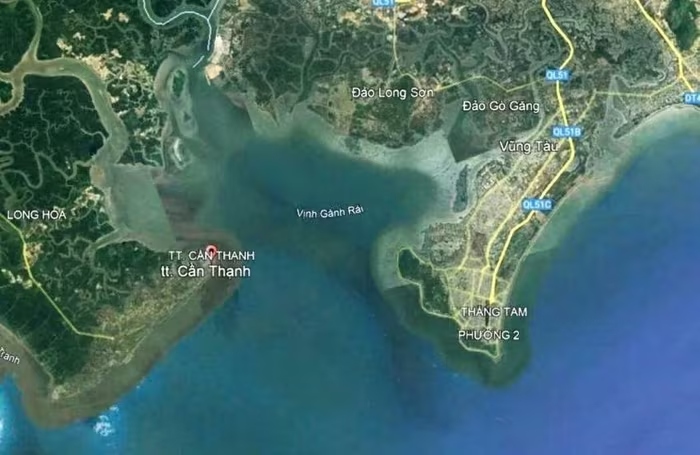
Ganh Rai Bay – where the proposed Can Gio – Vung Tau sea bridge might pass – is one of the most important maritime hubs in southern Vietnam.
In terms of concept, this is a highly commendable initiative. The southern coastal area has long been a region rich in economic, tourism, and ecological urban potential, yet its transport infrastructure remains limited, relying heavily on ferries and detour routes. A modern sea-crossing bridge would significantly reduce travel time, open a new coastal economic–tourism corridor, and become a new infrastructure landmark of Ho Chi Minh City after its expansion.
If properly planned, the project would not only solve transportation challenges but also expand urban, commercial, tourism, and marine service spaces, contributing to the formation of one of the most dynamic economic zones in southern Vietnam.
NEED FOR HARMONY WITH THE MARINE SPACE
However, for such a grand vision to become a sustainable reality, a comprehensive perspective is essential. Ganh Rai Bay – where the bridge may cross – is one of the most critical maritime routes in southern Vietnam. It is the strategic channel connecting the Cai Mep – Thi Vai, Phu My, and Long Son port complexes, the Can Gio international transshipment port, and, in the future, Cai Mep Ha.
In 2022 alone, cargo volume passing through this area reached approximately 290 million tons, accounting for nearly 40% of the country’s total cargo throughput. This figure clearly demonstrates the exceptional importance of this region — not only for trade but also for Vietnam’s import-export capacity and maritime standing on the regional map.
Besides being a “logistics artery,” the bay area also holds major significance for national defense, security, and energy, as it hosts critical facilities such as the Navy’s Region 2 Command, Ba Son Shipyard, Vung Tau Energy and Technical Support Center, Vietsovpetro Port, and the Long Son Petrochemical Complex.
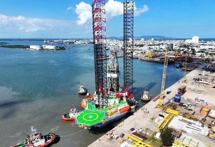
Operations at Vietsovpetro Port.
Notably, to support Vietnam’s offshore wind power development under the adjusted Power Plan VIII, the World Bank, together with the Danish and Norwegian embassies, has assessed that Ganh Rai Bay possesses several ports meeting criteria to participate in the offshore wind supply chain — the most crucial being unrestricted air clearance (height for large vessels to pass).
Specifically, in 2024, the Norwegian Embassy in Hanoi officially handed over to the Ministry of Industry and Trade the report “Offshore Wind Supply Chain for Vietnam’s Rapid Development Scenario.” This means the area is being positioned in the national marine spatial development plan — where Vietnam aims to build a complete offshore wind supply chain, from manufacturing and assembly to transportation and export of equipment. If a sea-crossing structure is built that alters or obstructs the route for specialized vessels, it would not only affect current maritime operations but could also impact Vietnam’s future green energy industrial development plan.
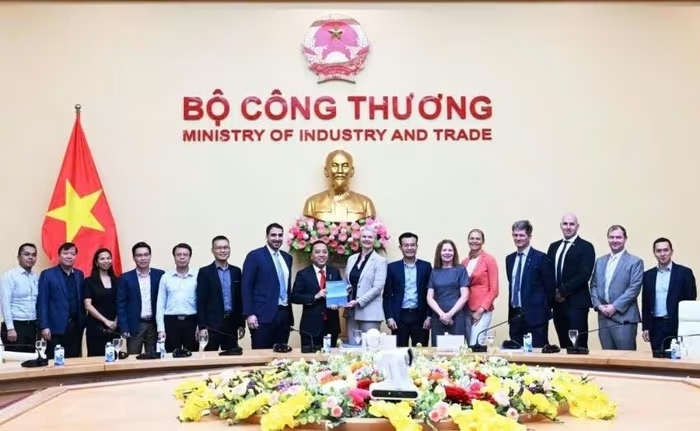
The Norwegian Embassy in Hanoi hands over the report “Offshore Wind Supply Chain for Vietnam’s Rapid Development Scenario” to the Ministry of Industry and Trade, October 2024.
To visualize this, a mega-container ship carrying 24,000 TEU stands about 70 meters tall, while a self-elevating drilling rig can reach nearly 150 meters, and floating wind structures can extend up to 300 meters — equivalent to a 100-story building. Clearly, constructing a bridge several hundred meters high to accommodate all these vessels is impossible. And if the bridge is designed lower, it would immediately become a “bottleneck” on this vital maritime route, obstructing marine transportation, oil and gas operations, and renewable energy activities — all of which are and will remain pillars of economic development and national energy security.
In fact, many countries have faced similar dilemmas — where the design decision of a sea-crossing bridge ended up affecting the maritime industry for decades. For instance, the Øresund Bridge (Denmark–Sweden), with a clearance height of only 57 meters, prevents many ultra-large container ships and wind component carriers from passing, reducing port efficiency. In Asia, the Tsing Ma Bridge (Hong Kong) faces similar issues, restricting vessel access and diminishing Hong Kong Port’s competitiveness against Singapore and Shenzhen.
These lessons show that a transportation project, if not carefully calculated for navigational clearance, can directly impact a nation’s maritime capacity, thereby reducing the competitiveness of Vietnam’s seaports in the regional landscape.
HARMONIOUS SOLUTION: COMBINED BRIDGE–TUNNEL MODEL
Many countries have adopted the combined bridge–tunnel model to simultaneously develop road transport and maintain safe passage for strategic shipping routes. Notable examples include the Chesapeake Bay Bridge–Tunnel (USA), the Øresund Fixed Link (Denmark), and the Hong Kong–Macau–Zhuhai Bridge–Tunnel system — all designed in this way: a bridge spans sections far from shipping lanes, while the segment crossing the main maritime route is constructed as an underwater tunnel.
This could be the optimal solution for the proposed Can Gio – Vung Tau sea bridge, allowing the project to serve as both an architectural landmark and a safeguard for uninterrupted maritime flow — paving the way for sustainable growth in Vietnam’s port, industrial, and energy sectors.